Galleri F 15

Mind the Map

21. Jun - 21. Sep 2014

In May 2014 Norway will celebrate the 200-year anniversary of its constitution, a time of great festivity around the country. Punkt Ø will join the celebrations by exhibiting archival maps from around the time of the signing of the Moss Convention – the de facto peace treaty that formed the basis for the union between Sweden and Norway.

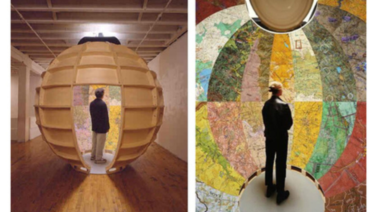
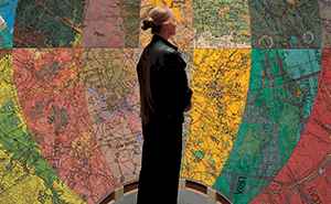
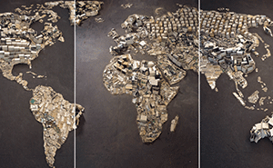
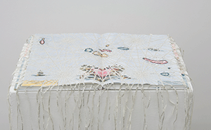
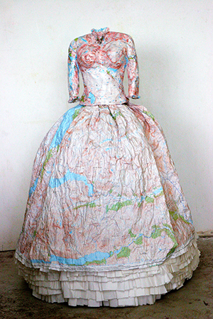
The historical maps will be complemented by a more comprehensive presentation of contemporary art featuring work by artists who work with cartography and maps either directly or in a more subtle manner, resulting in an exhibition that is political, poetic, conceptual and highly visual, revealing issues related to power and power structures and geopolitics seen from the perspective of a world in constant change.


Artists

Mona Hatoum (Libanon), Bouchra Khalili (Morokko/Frankrike), Joyce Kozloff (USA), Miler Lagos (Colombia), Kevin Simón Mancera (Colombia), Julie Mehretu (Etiopia/USA), Fabio Morais (Brasil), Vik Muniz (Brasil), Rosana Ricalde (Brasil), Susan Stockwell (England).

2 Balançoires, 2010. Sandblasted Glass And Stainless Steel. Photographer Joerg Lohse. Courtesy Of Alexander And Bonin, New York

Mona Hatoum Balançoires, 2010. Sandblasted glass and stainless steel. Photographer: Joerg Lohse. Courtesy of Alexander and Bonin, New York

3 Bouchra Khalili The Constellations, Silkcreen Print On BFK Rives Paper, Mounted On Aluminum. Courtesy Of Galerie Polaris, Paris

Bouchra Khalili The Constellations, Silkcreen print on BFK Rives paper, mounted on aluminum. Courtesy of Galerie Polaris, Paris

4 Targets, 2006. Mixed Media Installation.Photographer Sergio Martucci. Courtesy Of DC Moore Gallery, New York

Joyce Kozloff Targets, 2006. Mixed-media installation.Photographer: Sergio Martucci. Courtesy of DC Moore Gallery, New York

5 Miler Lagos Courtesy Of AB Projects, Toronto

Miler Lagos Lat 65.31 N Long 114.13 W, 2011. Single channel video, 15´01”. Courtesy of AB Projects, Toronto

6 Kevin Simón Mancera La Felicidad, 2012. Drawing On Paper. Photographer Edoard Fraipont. Courtesy Of Nueveochenta Gallery, Bogota And Galeria

Kevin Simón Mancera La Felicidad, 2012. Drawing on paper. Photographer: Edoard Fraipont. Courtesy of Nueveochenta Gallery, Bogota and Galeria Vermelho, Sao Paulo

7 Julie Mehretu WWW (Pictures Of Junk), 2008. 3 Digital Chromogenic Prints. Courtesy Of Xippas Galleries, Paris

Julie Mehretu WWW (Pictures of Junk), 2008. 3 digital chromogenic prints. Courtesy of Xippas Galleries, Paris

8 Fabio Morais Encontro De Mares, 2006. Atlases And Books. Photographer Fabio Morais. Courtesy Of Galeria Vermelho, Sao Paulo

Fabio Morais Encontro de Mares, 2006. Atlases and books. Photographer: Fabio Morais. Courtesy of Galeria Vermelho, Sao Paulo

9 Vik Muniz Amore And Psiche, After François Gerard (Pictures Of Junk), 2009. Digital Chromogenic Print. Courtesy Of Xippas Galleries, Paris And

Vik Muniz Amore and Psiche, after François Gerard (Pictures of Junk), 2009. Digital Chromogenic Print. Courtesy of Xippas Galleries, Paris and Thomas Dane, London.

10 Rosana Ricalde Atlas Marco Polo, 2009. Cut Out Text From The Book ‘The Travels Of Marco Polo’, Placed Over An Atlas. Courtesy Of 3+1 Contemp

Rosana Ricalde Atlas Marco Polo, 2009. Cut-out text from the book ‘The Travels of Marco Polo’, placed over an Atlas. Courtesy of 3+1 Contemporary Art, Lisbon

11 Susan Stockwell Highland Dress. 2008. Paper Maps, Rice Paper And Metal Frame, Photo By The Artist.

Susan Stockwell Highland Dress. 2008. paper maps, rice paper and metal frame, photo by the artist.

12 La Norvège à La Réunion Avec La Suède, Ou Division Naturelle, Civilie Et Militaire De La Norvège, Conjoinctement Avec Sa Force Militaire En 1814.

La Norvège à la Réunion avec la Suède, ou Division Naturelle, Civilie et Militaire de la Norvège, conjoinctement avec sa Force Militaire en 1814.

Historical maps

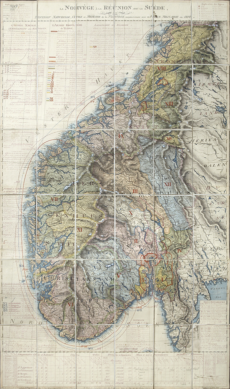
In the exhibition there will be historical maps, including them map La Norvège à la Réunion avec la Suède, ou Division Naturelle, Civilie et Militaire de la Norvège, conjoinctement avec sa Force Militaire en 1814.

According to what is written on the leather case, this map was drawn by Otto Julius Hagelstam (1775-1870). He was a Swedish officer and around 1814 was involved in the transfer of maps and documents from Denmark to Sweden. It was in connection with this work that he gained a more elementary understanding of cartography. He published a map of Norway in 1815, and it may well be that this is the manuscript to that very map. Hagelstam is otherwise most well known in Norway for his detailed map of Christiania dated to 1816.

What is interesting about this map is that it not only shows the Norwegian-Swedish land areas, but also contains a great deal of statistical and administrative information – as can be seen on the printed edition dated to 1820. This is, in other words, a form of reference book for interested parties.